This time I give you something vaguely related.
For such an interesting little area, it is surprisingly rarely visited. Or maybe it isn't so surprising after all...
As always, post a comment with latitude and longitude and write something about the (geologic/geographic/hydrographic) feature in the picture. If you win, you get to host the next one.
Previous WoGEs are collected by Felix on his blog and a KML file.
47.4689 S, 67.9428 W
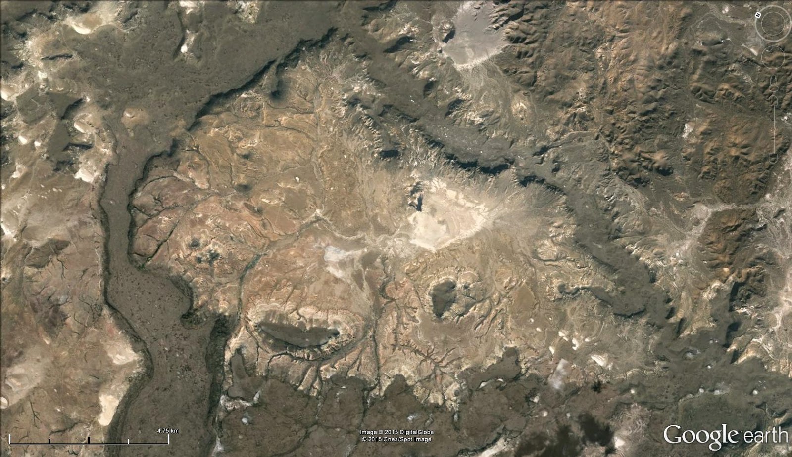
SvarSlettBosque Petrificado Jaramillo Natural Monument, Santa Cruz, Argentina
Here we have a petrified forest (bosque petrificado), formed when a Cretaceous forest (including trees of genus Araucaria) was buried under volcanic ash from Andean volcanoes. Source: http://www.patagonia-argentina.com/en/petrified-wood-natural-monument
This particular section includes what appears to be an endorheic basin, and based on the coloration, the presence of mesas, and some of the user pictures on Google Earth, I would venture to guess that the dark unit is a lava flow (andesite?), rather than the less resistant, lighter-colored tephra deposits.
The search was relatively short once I started. From the shadows, it was clearly in the southern hemisphere, and that arid, dark coloration is strongly suggestive of Argentina or Chile. By matching the colors and looking for an endorheic basin with a little mesa in it, I was able to find the location.
Correct - mostly. I believe this basin is outside the bosque petrificado national park, but it is all related anyway.
SvarSlettAs endorheic basins go, this one is a bit of an outlier: Inside the basin are upper Jurassic sediments, completely enclosed by a lower Cretaceous lava wall. So where did the Cretaceous tephra go? There can't have been much erosion there, since there is no route for anything to be transported OUT of the basin! The lava wall looks like it might be one flow curving around the basin, most likely following a natural depression such as a river bed. That means that what little sediments were there have been removed by wind, since no water can flow out.... And that again means that the surface in there is pretty much what it was when it was closed off. As you noticed the colours inside are a good match for those on the outside, meaning that it is most likely the same rocks, which are pretty easy to date.
I was a bit unsure of the assignment to the national park, but with no park boundaries showing, I hoped that nearby picture captions would get me where I needed to be. That's generally how I figure out what exactly I'm looking at, and what to search for to get information on the geology.
SvarSlett***
WOGE 492 is available here: https://inquisitiverockhopper.wordpress.com/2015/05/23/where-on-google-earth-492/
That's what I do too, and then I try to draw infrernces from what is not mentioned in the picture captions. Argentina is a great area for visible geology, and there is a fairly large area where all the pictures were taken by geologists, thay even have formation names! Even better than paleokazakhstan. ;)
SvarSlett